


University : Damascus University
Tutor(s) : Prof Ahmad Amar Jabri
Project Description
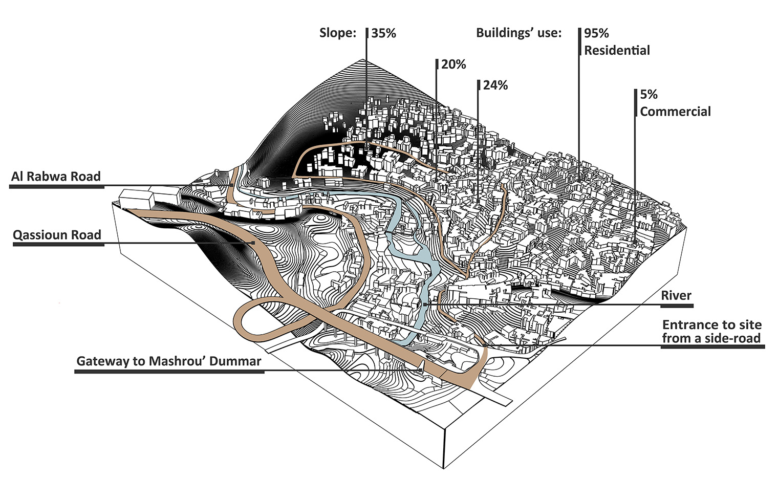
– The illegal urban settlements on public land which usually grow over a period of time in a constant and sporadic manner. The existence and rapid growth of slums including to the increase in the number of people living in slums in Syria have drawn our attention to the importance of finding an alternative yet affordable housing approach. We chose Al – Rz mountain in Damascus to be our case study due to many reasons:
1 -Its geographical significance to the city since it is located on the main road between the two main parts of the capital. This road (Al – Rabwa) is also the home to many popular parks and restaurants which are visited by Syrians a lot, due to the natural environment surrounding it, such as Barada river and Qassioun mountain. Both of those names are the main characteristics of Damascus city. Our project is located on the mountainside with a huge visual connection to that road.
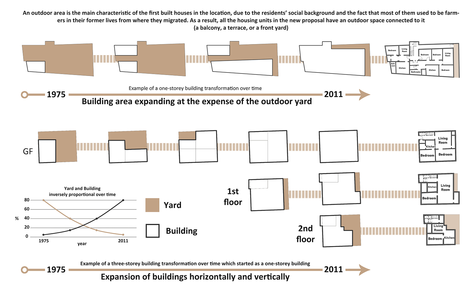
2-The extreme current physical conditions of the slums on the site, and the lack of basic services, which also affect: 3-the social situation of the residents negatively. Jabal Al-Rz is the name of the location of our project which is a part of a bigger slum area called Wadi Al-Masharee’. Those two areas are situated on a steep mountainside outlooking Mashrou’ Dummar, which is a well-planned region with an efficient amount of services to fulfill its residents’ needs. As the informal settlements began to emerge in the 1980 s with no regard for basic human needs (access to water and electricity, sanitation, schools…), the new inhabitants had to reach out to the neighboring areas, putting pressure on their facilities. However, this did not stop the migration toward this area by people who are seeking to live closer to the city. By 2011, this region contained more than 2500 houses, none of which apply to the right living conditions. The houses are too small and yet, house more than 7 members each. The houses also suffer from humidity, lack of sunlight, and bad ventilation. All this information is based on the master’s thesis of Architect Shireen Al Abyad in 2011.
Project Area: 5 Hectares
The chosen project area is located at the main entrance to the site because the main existing roads that are not very steep were preserved.
Urban planning: The proposal was based on reliable studies made by Architect Shireen Al-Abyad in her Master’s thesis, including our visits to the site, in order to propose a planning strategy that best suits its needs.
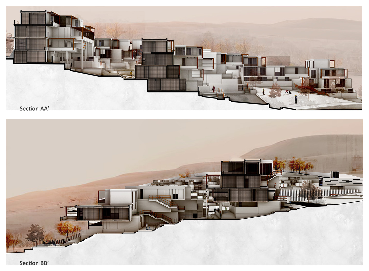
Architecture Design: The site was redesigned with regard to the main sustainable, economic and urban standards. All are designed according to a structural and architectural grid.
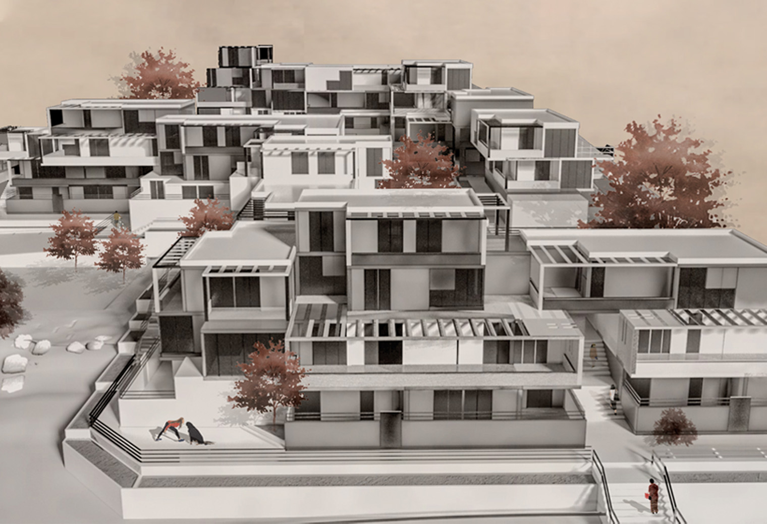
Detailed plan: The proposal included a detailed housing plan and a commercial service center that both took into account the land contours. The proposal is to build affordable housing, designed with consideration of the sloped mountainous topography, and the social aspect of the residents, as well as provide a safer environment and a visually adequate design. This approach could be possible by rebuilding the area gradually over time, thus, providing a replacement shelter in the areas that are yet to be rebuilt to the residents while construction. To achieve economic feasibility, the proposal strived for raising the density, allowing new residents to purchase new houses in the area and not just find replacements for the original settlers. This raised the population density from 250 people per hectare to 350.
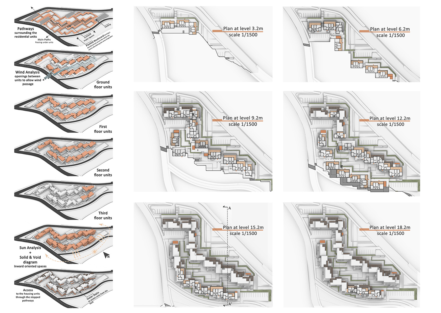
-The land was divided into two parts according to the slope so that the distribution of the volumes occurs most efficiently.
-Each part followed a different grid parallel to the site contours. Both grids were 7.2*7.2m -The residential blocks consisted of three different types of units which were repeated along the whole site.
-The 3 units are distributed organically along the mountain according to the slope as well as ensuring a coherent structural system among all three units while preserving a level of privacy for the residents.
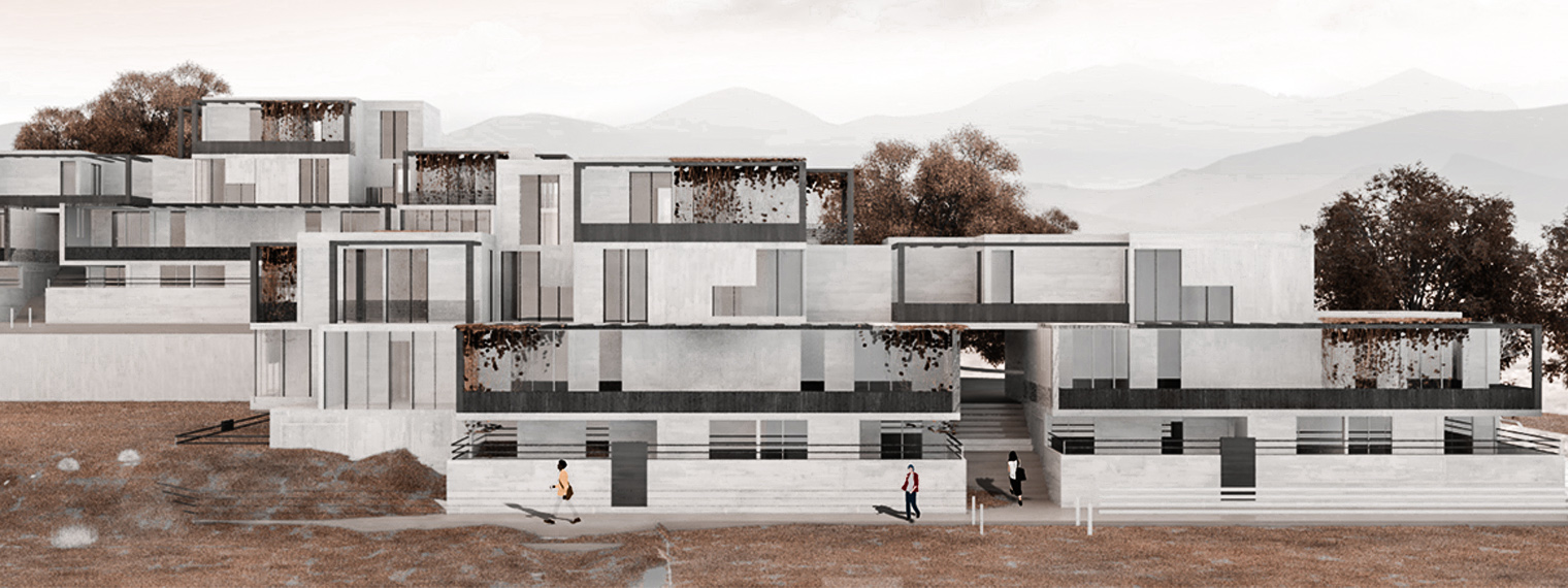
-The main visual and movement axes penetrate the site and continue under the units, which is possible by leaving an empty module between units.
-Leaving an empty unit also made the way for wind to flow more along the site, providing better ventilation.
-Secondary movement pathways flow around groups of several housing units.
-Housing groups create semi-public spaces between them, giving a sense of enclosure and safety.
-Small shops are distributed across the whole site to provide for the residents’ needs.
-Parking lots are distributed collectively across the site.
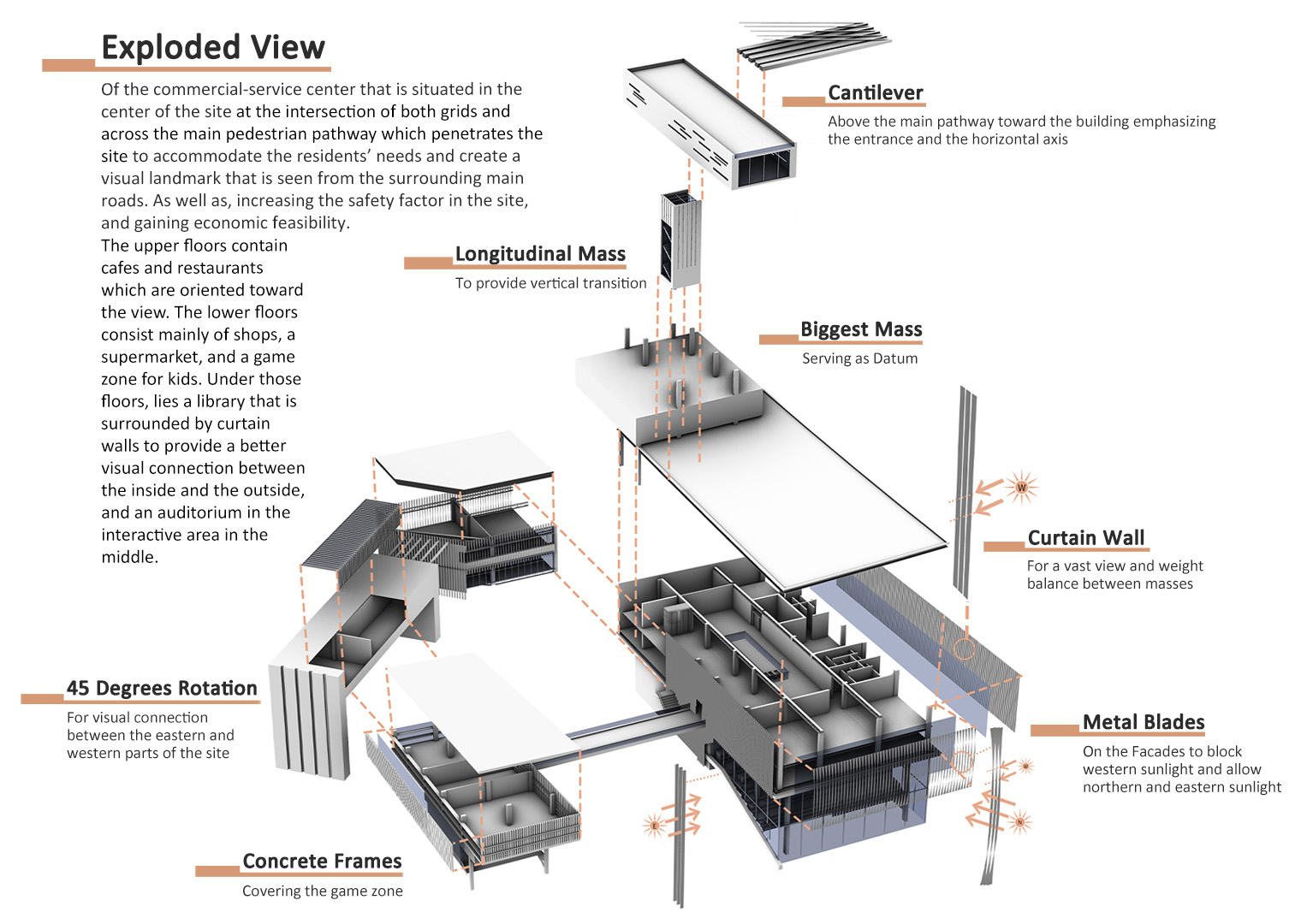
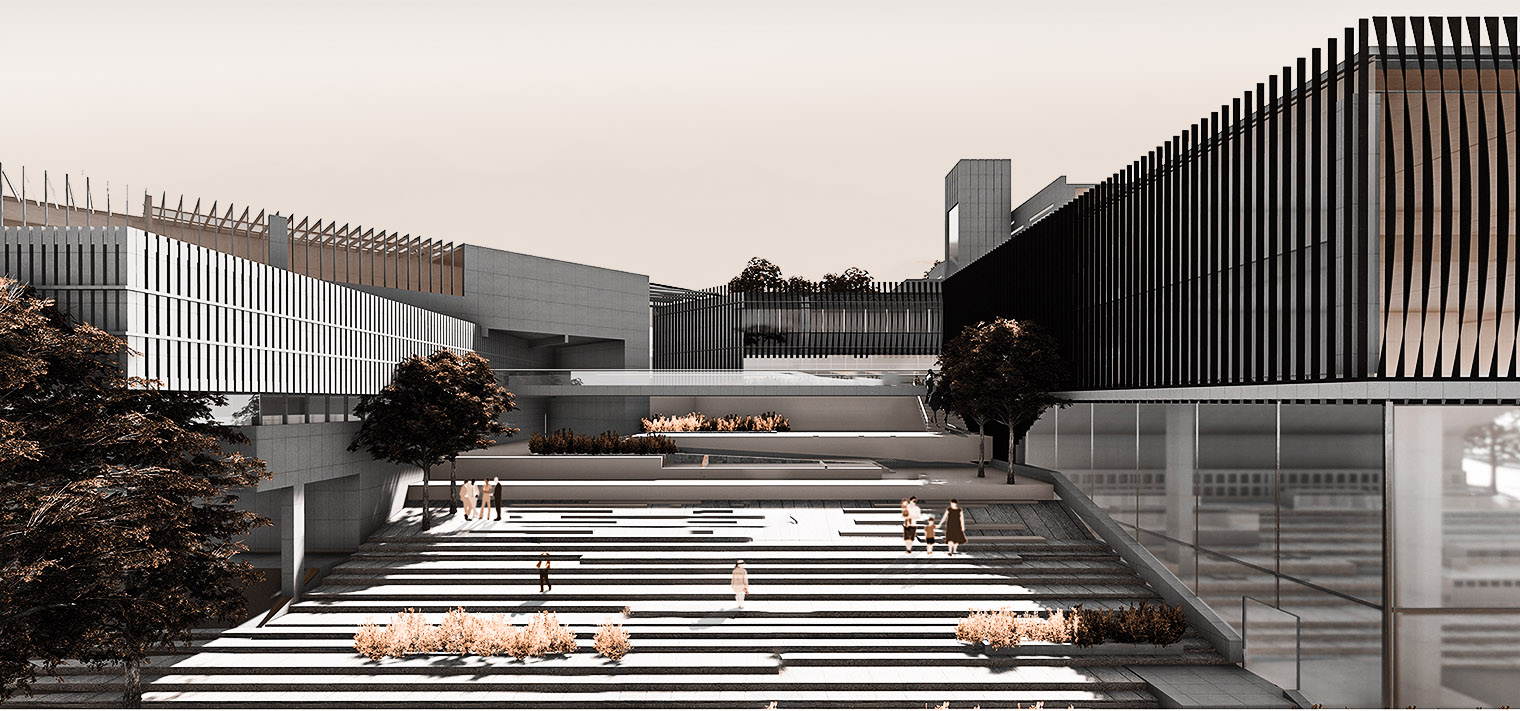
-At the intersection of both grids and across the main pedestrian pathway which penetrates the site, a commercial and service center was placed.
-The commercial service center is located in the heart of the site, to provide the region’s needs and create a landmark that is visually clear from all the surrounding areas. The orientation of the masses that form this center follows both grids in the site, creating a visual connection between the eastern and western parts of the site. The upper floors contain cafes and restaurants which are oriented toward the view. The lower floors consist mainly of shops, a supermarket, and a game zone for kids. Under those floors, lies a library that is surrounded by curtain walls to provide a better visual connection between the inside and the outside, and an auditorium in the interactive area in the middle that has a sense of enclosure, due to the positioning of masses accordingly.
Established in 2012, Tamayouz Excellence Award is an unaffiliated, independent initiative that aims to advance the profession of architecture academically and professionally. Tamayouz is dedicated to supporting aspirational and transformative projects that tackle local and global challenges and that are informed by a holistic understanding of context.